Previous Chapter
Sunday 17th June 2007
Dolgellau to Crickheath
The first part of today's ride was 10 miles along the main road to Bala. I wasn't looking forward to this part of the ride, but in the event there was hardly any traffic on the road and we were off the main road by 10 in the village of Llanelltyd. As well as the ride I had a new task to do. A couple of weeks before leaving I had discovered a website - www.geograph.org.uk - which is trying to achieve a data base of pictures covering all the 1km grid squares in the UK. People are invited to send their pictures in - and if accepted as the first picture for a square one is awarded points. Points don't mean prizes in this case! I had therefore set to and made a list of all the squares we were passing through which had not been photographed - there were about 40 of them on the ride. Tony was informed that there might be delays to the ride in places, but he was quite happy (I think) to go along with the idea.
The first square to photograph was SH8224 a couple of miles up the road from our start point. It wasn't too difficult to find a suitable subject here - the stream flowing alongside the road - but as the trip progressed it became clear why some squares had not had photos taken. More on this later.
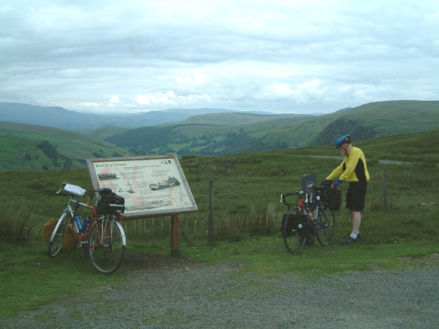
So we moved to the hills - in fact climbing over the highest pass in North Wales - on our way to Lake Vrnywy. The climb itself wasn't too steep - it just carried on for rather a long time. Eventually we reached the summit of Bwlch Y Groes and had tremendous views for miles around, before beginning the descent to the lake. The weather was being very kind to us and others were out taking advantage of this. In fact we saw more cyclists on the road that morning than we saw cars! 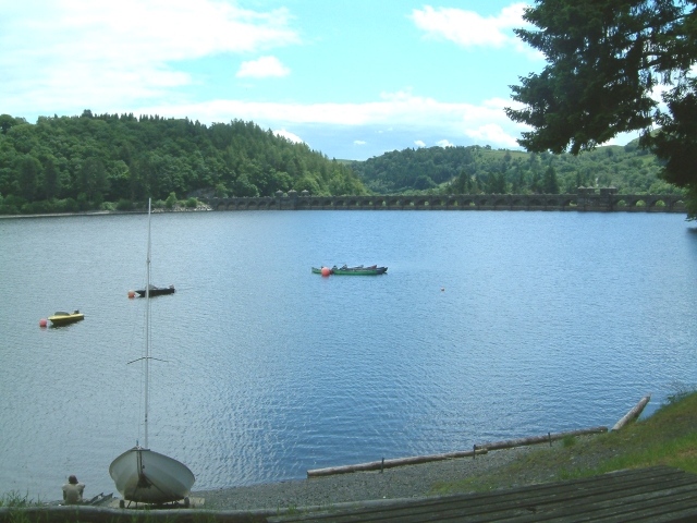 We got to the dam at the far end of the lake just about lunchtime so having little food on board we made straight to the cafe and had a very welcoming bowl of soup.
We had a short climb away from the lake after lunch - but nothing too strenuous this time - before we joined the Tannat valley - following this road for miles as it made its way eastwards following the river. The number of squares without photographs reached a peak along this stretch of the road and we seemed to be forever stopping to capture the scenery. It was interesting though how this made us far more observant than we normally would have been and added a new dimension to previous cycling trips. Eventually half way through the afternoon we reached the village of Llangedwyn were a notice suggested that tea was on sale 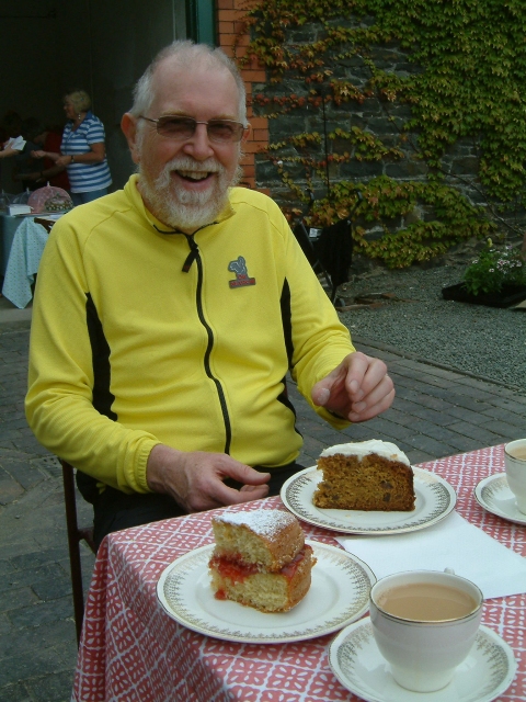 at a craft centre just off the main route. We followed the side road for a short distance only to find the centre well and truly closed for the day - well it was Sunday and we were in Wales. However we spotted an advert on a gate suggesting that Llangedwyn Hall was open to the public for its annual National Garden day. This was only a short distance away and we were soon eating vast quantities of cake and drinking tea. If you thought Tony looked unhappy on the first photo he certainly wasn't now!
And so having replenished our energy levels we journeyed on south of Oswestry and to the small village of Crickheath. The B&B turned out to be situated right alongside a disused section of the Montgomery canal - a very pleasant spot - and we were soon made very welcome by our hosts for the evening who served us with more tea and cake in the garden and chatted to us about the plans to refill the canal. It is now navigable to within about a mile of the B&B.
The mileage for today was 60.5 miles making a total of 83.1 miles.