Previous Chapter Return to Tony's Home Page
Day 7
Thursday 29th April 2004
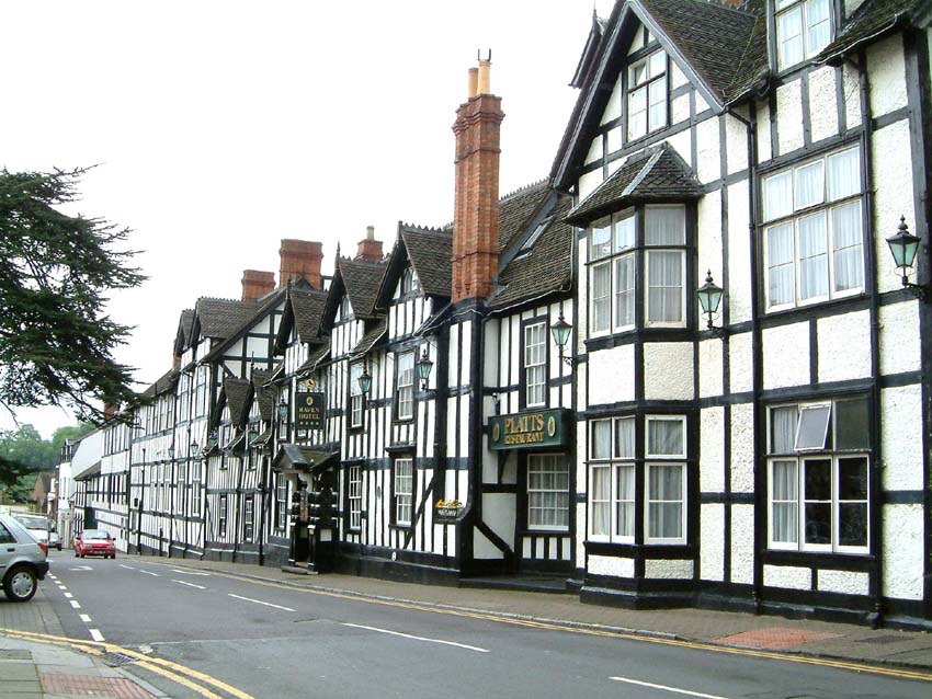
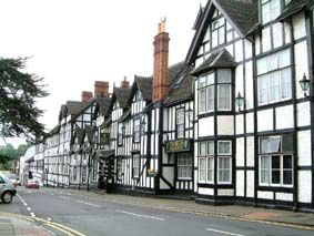
Fownhope
to Walcote (near Alcester)
My
hosts at last nights B&B were very chatty.
Their garden was to be opened to the public on the following Sunday. They
had run the village Post Office for 3½ years; she had designed their house
which was built about 6 years ago. The
bathroom – which I had to myself - had as much floor area as the front room at
home if not more. They ran a private
taxi service and she had taken someone to Cardiff
airport in the middle of the night leaving at
3.20am
and returning at 6.30 in time to cook my breakfast at 7.30.
I
eventually got away at
9am
. I am being very lucky with the
weather – heavy rain in the night came to an end while I was eating breakfast
– and apart from an odd spot it remained dry for the rest of the day.
It was not the water overhead which was to be a problem.
The initial problem was the cold north wind.
I had extra layers on including my waterproof overshoes, but there were
still times when my feet got cold. The
best way to cure this I found was to do more walking when it came to the hills.
I
left the CTC route and started to make my way towards the
Malvern Hills
and Worcester
to the north east. I had found a
route which seemed to miss many of the major roads but it had one or two
disadvantages which I was to find out later.
The first was that it was too rural.
There was a distinct lack of villages and shops to buy my lunch or tea
houses for mid morning breaks. The
only sizeable town I would be going through would be Alcester which was at the
end of the day. I didn’t expect
the route to be so uninhabited. I
didn’t have much food on board either. I
ate my one and only banana overlooking the River Teme at Knightwick.
The river was in full flood as a result of the heavy rain of the past few
days. The banana was followed half
an hour later by a roll left over from yesterday with some cheese spread and ½
tomato, also from yesterday, and one of my emergency breakfast cereal bars.
These were all eaten in a wood just outside Sinton Green – I think it
was called Monks Wood but I may be wrong. Up
to this point the route had been fairly satisfactory apart from one deviation
that I made in order to avoid a hill which I went round rather than over at
Knightwick.
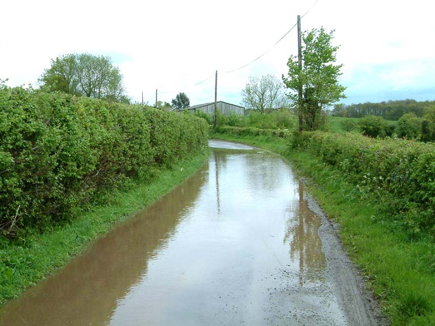
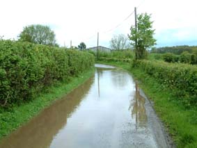 Soon
after this I came across my second problem.
The road ahead of me was completely flooded.
The only good thing about it was the reflection!
Just at that moment a car came round the bend in the opposite direction
and ploughed through causing the reflection to disappear – so much for the
picture! From what I could see of
the road it looked that if I kept to the right hand side it wouldn’t be too
deep. This turned out to be true –
until I got too far to the right and dropped down into an unseen gully.
I managed to wrestle the bike back onto the proper surface without
falling off. I had survived without
getting my feet or my panniers wet – it was a close thing.
Soon
after this I came across my second problem.
The road ahead of me was completely flooded.
The only good thing about it was the reflection!
Just at that moment a car came round the bend in the opposite direction
and ploughed through causing the reflection to disappear – so much for the
picture! From what I could see of
the road it looked that if I kept to the right hand side it wouldn’t be too
deep. This turned out to be true –
until I got too far to the right and dropped down into an unseen gully.
I managed to wrestle the bike back onto the proper surface without
falling off. I had survived without
getting my feet or my panniers wet – it was a close thing.
I
then reached the small village
of Grimley
a few miles north of Worcester
where it looked on the map as though there was a bridge across the
Severn. Here I found problem number three.
My map gives prominence to place names and roads disappear under names to
re-emerge out from the other side. I
thought this happened at Grimley. It
didn’t – the road ended, there was no bridge to be seen and when I asked a
local I got a reply in the affirmative. I
had the choice of going 4 miles south via Worcester
or 3 miles north to join a main road into Droitwich.
Not the best of cycling conditions in either direction.
I chose the latter feeling rather dejected.
After about 3 miles, I turned onto the very busy A4133 but just around
the corner I came across a Garden Centre with “Bramleys Coffee Shop”
attached. Things were looking up.
Four cups of tea from the pot for 90p plus a blackberry and apple crumble
with real custard for £2.50. I then
bought some flapjack from the farm shop just in case I was feeling hungry a bit
later!
 I
proceeded very carefully along the main road into Droitwich – the traffic was
the worst so far of the entire journey. From
Droitwich I managed to pick up a B road with much lighter traffic conditions
which took me all the way into Alcester, 14 miles away.
The time was about 4.30, I had covered 56 miles and I was on the look out
for B&B’s. There were very few
advertised along the roadside, but fortunately I came across the Library and
Information Office in the middle of the town – perhaps they could help.
Yes – and they had recently updated their lists.
It was noticeable that we were in the
Stratford
on
Avon
area – the prices are certainly higher round here.
The cheapest was £25 and this was going in the wrong direction.
The next best was £30 at Walcote near to Great Alne.
I
proceeded very carefully along the main road into Droitwich – the traffic was
the worst so far of the entire journey. From
Droitwich I managed to pick up a B road with much lighter traffic conditions
which took me all the way into Alcester, 14 miles away.
The time was about 4.30, I had covered 56 miles and I was on the look out
for B&B’s. There were very few
advertised along the roadside, but fortunately I came across the Library and
Information Office in the middle of the town – perhaps they could help.
Yes – and they had recently updated their lists.
It was noticeable that we were in the
Stratford
on
Avon
area – the prices are certainly higher round here.
The cheapest was £25 and this was going in the wrong direction.
The next best was £30 at Walcote near to Great Alne.
As I
approached Walcote there was another section of flooded road.
The stream alongside was on the point of overflowing its banks and in
fact the water level looked higher than the road level.
This time I had better luck. There
was a clear path through even though most of the road was covered in water.
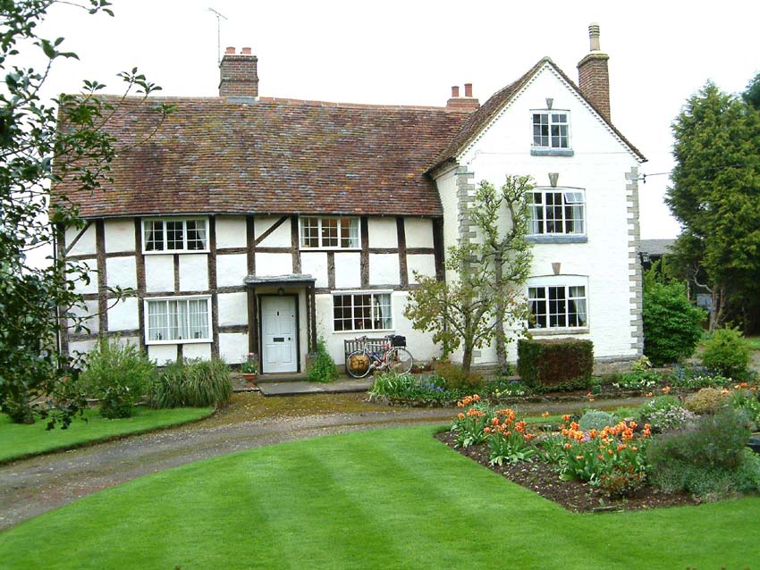
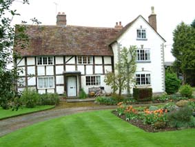 I
arrived at the farmhouse - a very old period farmhouse dating back to the
1700’s and again I was made very welcome.
The nearest pub however was at Aston Cantlow, a village with Shakespeare
connections – this brought up “£” signs in front of my eyes!
I took the cheapest option later that night – Bangers and mash with veg
for £12.40. I didn’t enquire
about the prices of the pudding – well I had had one earlier in the day.
I
have made good progress today. I had
covered a distance of 63.1 miles at an average of 9.4 mph.
This brings the total mileage up to 370.7.
Just a short trek to Hinckley
tomorrow of about 35 miles.
Next Chapter Return to Tony's Home Page
 Soon
after this I came across my second problem.
The road ahead of me was completely flooded.
The only good thing about it was the reflection!
Just at that moment a car came round the bend in the opposite direction
and ploughed through causing the reflection to disappear – so much for the
picture! From what I could see of
the road it looked that if I kept to the right hand side it wouldn’t be too
deep. This turned out to be true –
until I got too far to the right and dropped down into an unseen gully.
I managed to wrestle the bike back onto the proper surface without
falling off. I had survived without
getting my feet or my panniers wet – it was a close thing.
Soon
after this I came across my second problem.
The road ahead of me was completely flooded.
The only good thing about it was the reflection!
Just at that moment a car came round the bend in the opposite direction
and ploughed through causing the reflection to disappear – so much for the
picture! From what I could see of
the road it looked that if I kept to the right hand side it wouldn’t be too
deep. This turned out to be true –
until I got too far to the right and dropped down into an unseen gully.
I managed to wrestle the bike back onto the proper surface without
falling off. I had survived without
getting my feet or my panniers wet – it was a close thing.