Previous Chapter
Days 19 to 21
Alness to John o'Groats
Sunday 23rd June Alness to Lairg
 Another short day planned partly because we had been unable to get accomodation at the Crask Inn north of Lairg. We had therefore booked at the Lochview B&B overlooking Loch Shin - a highly rated B&B with a bedroom, sitting room and ensuite all to ourselves. When I last made the trip I had used the hilly B9176 road from Alness to Bonar Bridge. Fate probably decided for me that I should use the longer route via Tain which avoids the top of the hill and also the worst of the weather.
  Misreading the GPS and believing that the Sustrans A7 cycle route was what we wanted, I blindly followed the signs and ended up at Tain. Looking at the low cloud on top of the hill as we arrived at Bonar Bridge I think we made the right choice. At Bonar Bridge we found the only shop selling sandwiches and saw that there was a pub which said it opened at 12 for lunch. We waited patiently in the cold wind for the next 10 mins until midday. The advert for the pub turned out not to apply to Sundays - they were serving Sunday lunches but did not open until 12.30. Too cold to hang around so we set off again for Lairg which we reached soon after 1. We smelt the hotel serving Sunday roast dinners from the bottom of the hill - the afternoon was free even if the meal wasn't. We had experienced light showers and drizzle on the way but as we sat eating our meal it began to rain more heavily. We took a leisurely 2 hour lunch break and arrived refreshed at the B&B just down the road later that afternoon.
The stats for the day were 38.15 miles : 10.9mph : 1420ft climbed
Monday 24th June Lairg to Bettyhill
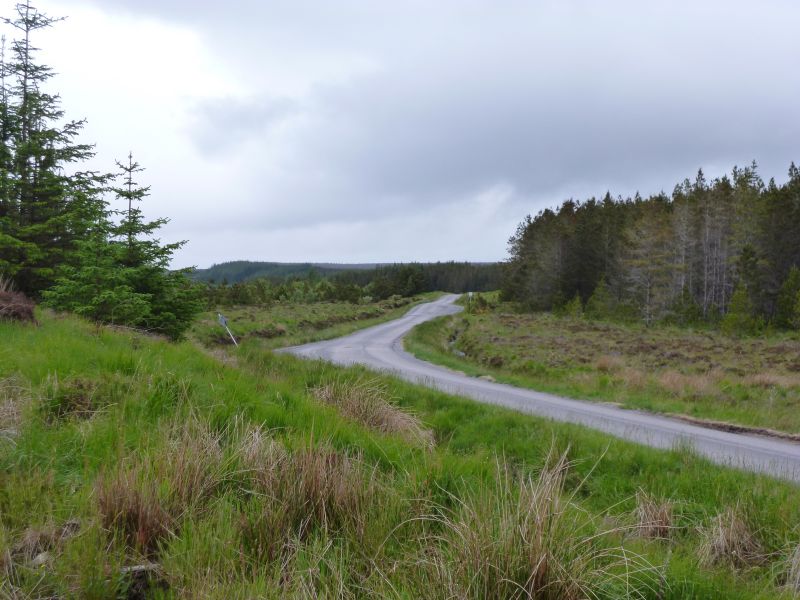 It was an improved weather forecast for today but still the threat of showers. The first 14 miles was up a gradual incline to the summit just past the Crask Inn.
 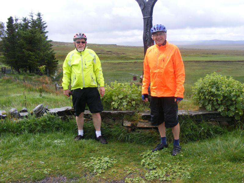 Half way there and it started to drizzle so by the time we got to the Inn we were dying for a cuppa. It was not to be as they were closed. Some German tourists took our photo by the Sustrans route marker. Once over the top of the hill the weather improved although it was still overcast. Offically it is now downhill all the way to Bettyhill as we follow the River Naver all the way to the coast. From previous experience this may be true for the first section, but as one approaches Bettyhill the terrain becomes undulating and eventually ends in a nice hill and the wind is invariably directly into your face from the north. We stopped at Altnahara for a cuppa and the soup on the menu looked very appealing to warm our inners. We were told that soup of the day was mushroom (not my favourite) but I had no option.
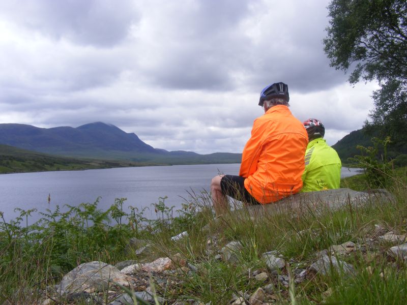
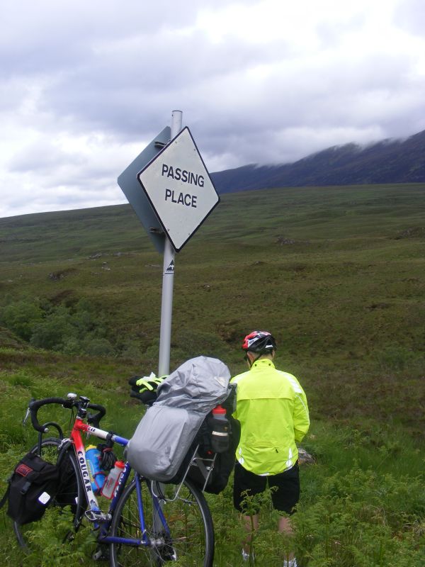 When it arrived it was almost black in colour (not what I found appealing) but nevertheless it helped greatly to warm us up. The wind all day had been blowing from the NW (not a good omen for Bettyhill) but as we cycled around Loch Naver we were able to find a sheltered spot to eat our lunch. Today lunch was a DIY affair as when we had left Lairg the shop could only provide us with plain rolls and cheese spread together with pork pie and ginger cake. It was hard going over the last 10 miles into Bettyhill with the strong Northerly in our faces. We eventually reached the Bettyhill Hotel at 4.30. We have discovered a new meaning to the sign "Passing Place" as we progressed along the narrow roads in Scotland as is illustrated by the photo of Tony W.
The stats for the day were 45.25 miles : 10.1mph : 1747ft climbed
Tuesday 25th June Bettyhill to John o'Groats
 Bettyhill Hotel is much improved since Christine and I last stayed there - the current owner is doing a lot to restore the building and although early days and the food choice is limited, we were well looked after. The view from the dining room is magnificent.
 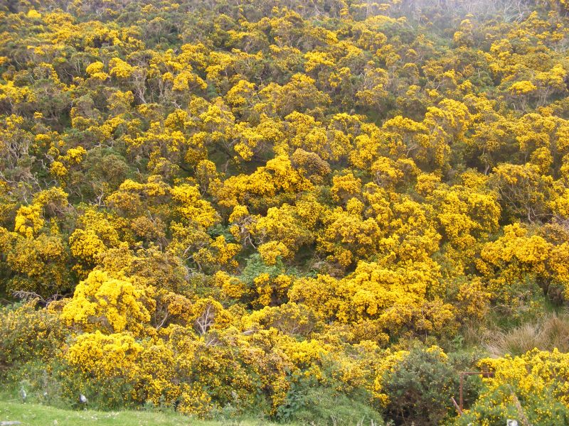 From Bettyhill along the coast to Caithness the going is tough with several steep climbs and descents. The hills are covered in gorse which makes a beautiful sight at this time of the year. Once into Caithness the going becomes much easier and the gradients less steep. We had the odd spot of rain as we progressed but fortunately the wind was aiding us on our way. At Melvich we stopped for tea in a pub and then cycled 5 miles to Reay to buy lunch. They couldn't provide ready made sandwiches so we did our own thing again.
 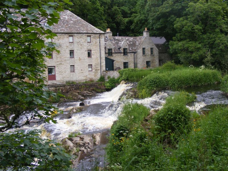 After another 5 miles we stopped at Forss where we sat on a bridge overlooking a mill to eat our lunch. While we were stopped some long distance walkers passed by who were part of a team of "Veterans in Action" from the forces who were suffering from Post-traumatic Stress Disorder. There were five teams of 2 members, each walking a 10 mile section each day - so between them covering 50 miles.
 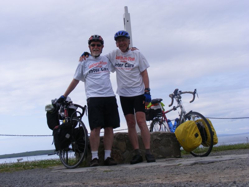 Their target was to walk from the north west of Scotland at Cape Wrath to the south east of England at Dover in about a month. At Thurso we stopped again for refreshment then arrived at JoG at about 4. There were far more people around than last time I was here when the place was like a ghost town. We took our own photos in front of a post which was signless (the official photographer could be contacted by phone if required!) and retired to the cafe to celebrate with - you guessed it - tea and cake. Next we bought our ferry tickets for the following day and were asked to arrive early so that the bikes could be loaded first. In the evening we went to the Sea View hotel for a celebratory three course meal. We had done it!
The stats for the day were 51.55 miles : 10.3mph : 2869ft climbed