Previous Chapter
Days 10 to 12
Montignac to Toulouse
Saturday 20th May Montignac to St Vite
Planned Route:
D76 to Les Eyzies de Tayac; D48 to St Cyprien;
D703 to Siorac en Périgord; D710 + D660 +D710 to St Vite (Fumel);
Distance 54.86 miles
The forecast was showers around midday and late afternoon but it soon became obvious that the weather had other ideas. It rained on and off throughout the morning and was mainly cloudy in the afternoon.
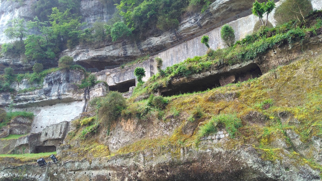 Our first target was Les Eyzies de Tayac at 15 miles. Just before reaching the village we passed La Roque Saint Christophe - a Cité Troglodytique - a limestone wall with cave dwellings that had been continuously occupied over many10's of thousands of years. There are many other caves and grottos in this area.
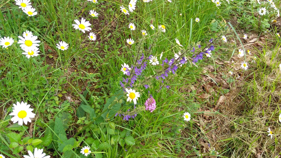 Leaving the village (where we had bought sandwiches with some difficulty and had tea) we took to the minor roads to climb up 400ft and over the first big hill of the day. As we have journeyed through France we have noticed the abundance of wild flowers and also the bird song. Our vista at the top looked out over the valley towards Siorac en Périgord the next major village.
 The first village at the bottom of the hill was Saint Cyprien with its very steep narrow lanes. Here we found an ancient abbey Église de Saint Cyprien. Founded in 400AD the present church is probably Norman. It was a massive building for such a small town. The walls appeared to be 3ft thick and the roof was very high even for a French church
On reaching Siorac en Périgord, half way, we sheltered under on park seat with "a roof" while having our lunch. We managed a cup of tea in a rather upmarket restaurant, as there was no tabac open. A good cup of tea and only 4 Euros. The next challenge was the highest summit of the day 790ft which turned out to be a doddle for two fit young men like us, even though it was uphill for 10 miles. Even better was the 18 miles gradual descent.
Have just had a superb 3 course meal in the Brit Hotel, for only 18 Euros each.
The stats for the day were 56.9 miles : 10.5 mph : 2727 ft climbed
Sunday 21th May St Vite to Moissac
Planned Route:
D102 to Tournon d'Agenais; D18 + D2 + D60 + D7 to Moissac;
Distance 38.38 miles
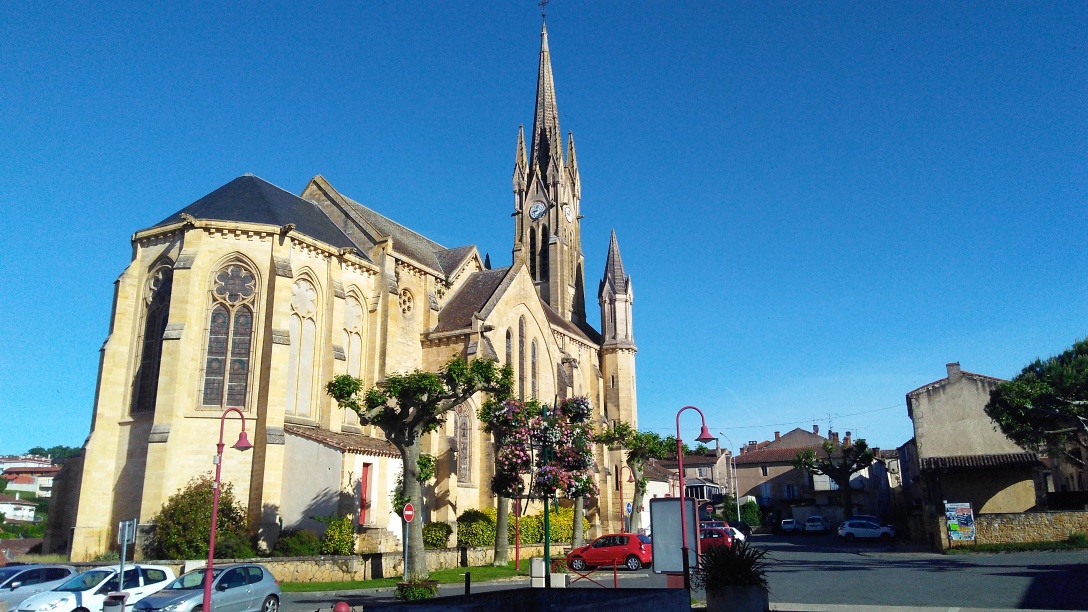 The breakfast was of the same standard as the meal last night. As we left we took a picture of the church at Fumel, which was right outside the hotel. By now the sky was almost cloudless although earlier in the morning we had watched the mist clearing from the hills. We called in to the Intermatché to replace a lost water bottle for TW and pick up supplies for lunch.
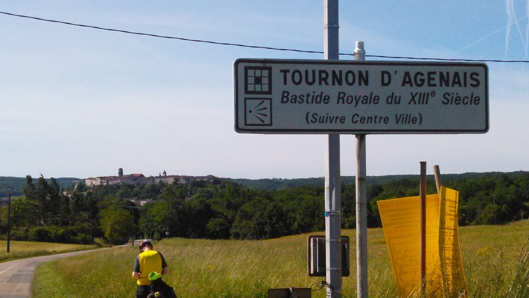 Soon after starting we hit the hills which in general were much steeper than yesterday's. After about 8 miles and more than an hours cycling we spotted the town of Tournon d'Agenais. We photographed it perched on the edge of the next rise and were lucky enough to get directions to a hotel for a nice cuppa.
More heavy climbing followed to get us to the summit at 850 ft. Unfortunately this was followed by a sharp descent which meant us climbing again to almost the same height. We stopped for lunch after about 18 miles near an old isolated church with an interesting churchyard. We noticed that the distance to Moissac was 5 miles closer than the route TT had originally chosen, so we decided to stay on the main road as there was very little traffic around.
Several more steep inclines followed until we arrived at Montesquieu where we approached some locals and asked if there was any chance of getting a drink. We were invited into a sort of community club and offered tea and some cold meats. They were preparing to watch a big rugby match at 3pm but we had to press on to Moissac which was another 7.5 miles. Luckily from this point on the terrain was either flat or downhill and we soon arrived in Moissac.
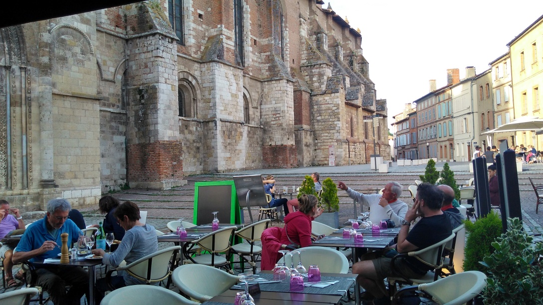 Later in the evening... We have just returned from a walk round the town centre including a visit to the magnificent Abbey with its amazing carvings at the entrance door and then dinner eaten in the Abbey square followed by a walk alongside the Canal du Midi.
The stats for the day were 35.2 miles : 9.3 mph : 2366 ft climbed
Monday 22th May Moissac to Toulouse
Planned Route:
Canal path to Toulouse;
Distance 41.32 miles
As we sat having breakfast we noticed numerous people walking by outside heavily laden with rucksacks. It turns out that the hotel is on one of the pilgrim ways that lead to Santiago de Compostela. This particular one starts in Le Puy and is known as the way of St James and crosses the Massif Central ending up in the so called sacred city on the Spanish border. It is 450 miles long.
 Paid a visit to the tourist office to obtain maps of the Canal du Midi cycle path and also visit the cloister. The Norman carvings on the pillars are unique - there are 76 of them around the central area . It is the oldest cloister in the world.
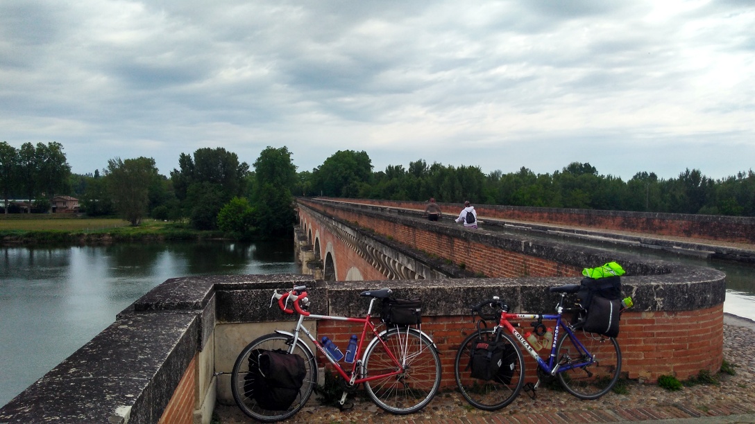 It was only a short distance from the centre to pick up the cycle path along the canal and within a mile, after about 5 locks, we passed over the viaduct which carries the canal over the river Tarn. The path here was cobbled apart from flagstones near the edge. Some brave (mad) cyclists were using this. We walked across!
 This part of the path was well used by runners, walkers, cyclist and also heavily laden long distance travellers. We continued on this path for almost 40 miles only venturing off to look for lunch and tea. Tabacs seemed to be very few and far between. We had one small cuppa about 11 but then didn't find another until about 3 when we left the track to enter a shopping centre on the outskirts of Toulouse. The ice cream was too tempting so we had 2 boules (scoops) each followed by a big pot of tea. The path surface was variable but in the main was ok for our touring bikes. We really appreciated the tree lined path as the shade kept us cool on this hot day.
The stats for the day were 45.7 miles : 9.8 mph : 615 ft climbed